Big construction projects have the tendency to change and derive from the original plan making it extremely necessary for the project’s stakeholders to see the “big picture”. Troy Willmon recaps and analyses his recent drone survey project.
Project analysis by Troy Willmon/ GM6 Solutions | November 30 2018
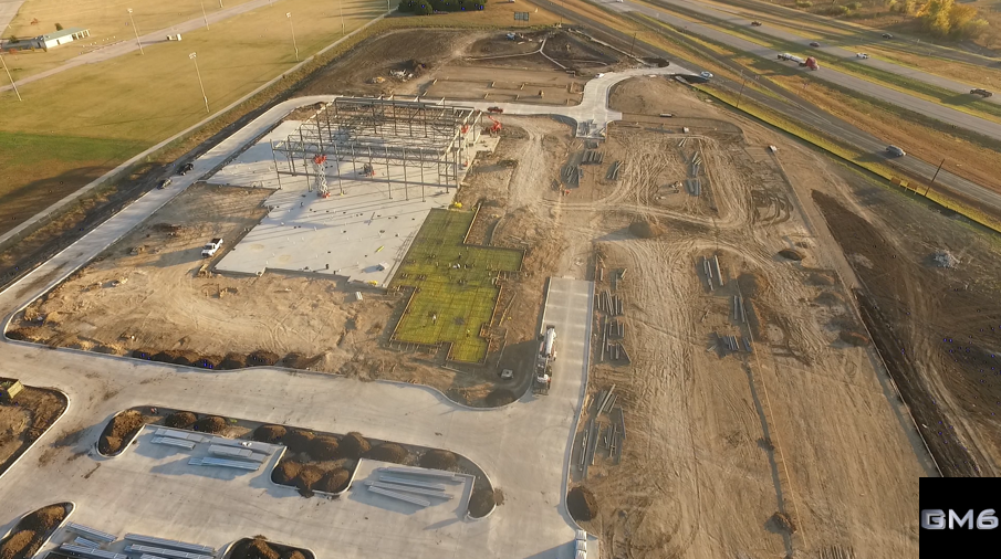
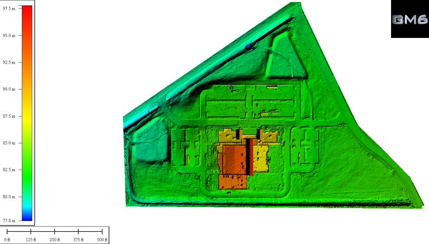
Here at GM6 Solutions, we work with various contractors in the field of construction, real estate and more. We recently completed a contract on a project that started a little more than a year ago - The lead contractor was Madison Construction. The project was a 64,000sq feet building on 17 acres of land.
Watch the video and read more below:
The beginning was easy...
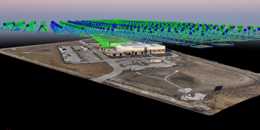
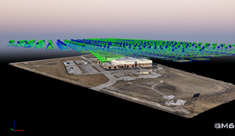
We started to survey and map the site before initial groundbreaking, to document the entire process, and used a Phantom 3 Pro at 200ft altitude, generating around 150-175 images.
After approximately 6-8 weeks of dirt work by the excavation company, the project manager for Madison Construction asked if we could create an up to date contour map of the progress. Since the land was flat in the beginning, the shape of the surface had changed dramatically.
As with any new and large construction project they must make sure that water would flow away from any structures and into the city drainage system. Additionally, the area designated for parking also had to allow for water to flow away while giving easy access to people in wheelchairs. That meant the grade or angle of the completed parking lot had to allow wheelchairs to maneuver through the parking lot easily and safely.
Unmanned drones vs. Human errors
Whenever a company hires a new contractor for the first time, a certain amount of risk is taken on by the lead company.
Using drones and Ground Control Points (GCPs) proved to be a very helpful way to confirm the excavator’s quality of work.
It allowed the construction company to see the project’s progress with a view from above, as well as allowing any project stakeholders to see and understand project changes.
Any construction company can hire someone with a drone to take a few pictures, but that does not allow them to make measurements that can be used to verify and correct potentially costly mistakes (which can end up being very expensive).
Think back to when you were in grade school as a child, when the teacher gave one student a sentence and told that student to repeat the sentence to the student next to them. By the time the information was passed all the way back to the first child, it was not even the same information at all.
That is the human factor. We are all flawed, and we pass along and understand information differently, but furthermore - with our own filters.
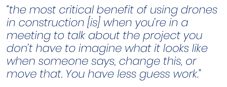
That is the first and, in my opinion, the most critical benefit of using drones in construction.
When you’re in a meeting to talk about the project you don’t have to imagine what it looks like when someone says, change this, or move that. You have less guess work.
A professional approach to changes
As the project changed, the needs changed. Some weeks the project manager wanted to check volumes or contours, some weeks a simple updated view was all he wanted.
We got to do a lot of experimenting on this job. We wanted to explore all options, including things we had not even thought about before the project. Besides the Phantom 3, we used a Mavic Pro, and a Phantom 4 Pro.
At some point, we learned that the Phantom 3 needed to fly at 100ft to get the image resolution that the construction company was happy with. That meant our Ground Sampling Distance (GSD) was extremely low. Lower than we needed. It also produced more images than we wanted. It was a tradeoff.
So we tried to use the Phantom 4 Pro it had better image resolution - but a narrower field of view. Although it made a better-looking map, it created more images than the phantom 3, with a lower GSD.
We could have flown higher, but we decided to see how much better things looked at the same altitude. Every change we made to improve one area, resulted in a sacrifice to another. We couldn’t find a single solution that would fit our needs.
Eventually, the best thing we did was trying different drones and combining different flight parameters. It confirmed many of the things that were simply theory to us before.
Lessons Learned
Overall, I can’t say I learned a perfect workflow that should be followed on every job. What I can say is that I learned how to overcome difficult challenges.
I’ll admit - I absolutely hated some of the lessons I was learning at the time, but the experience I gained from jumping in head first is an invaluable tool I will keep forever.
I will Never stop learning, I will never stop asking questions.
About GM6

GM6 offers quick tips and tutorials on UAS (Unmanned Aircraft Systems) Mapping. We use various types of aerial mapping software to capture images for mapping anything from commercial properties to crime and crash scenes. Learn how you can save time & money with drone mapping.